


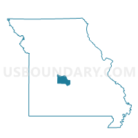
Decaturville Voting District, Camden County, Missouri
About
Outline

Summary
| Unique Area Identifier | 607340 |
| Name | Decaturville Voting District |
| County | Camden County |
| State | Missouri |
| Area (square miles) | 42.28 |
| Land Area (square miles) | 42.28 |
| Water Area (square miles) | 0.01 |
| % of Land Area | 99.98 |
| % of Water Area | 0.02 |
| Latitude of the Internal Point | 37.92674540 |
| Longtitude of the Internal Point | -92.69450320 |
Maps


Graphs
Select a template below for downloading or customizing gragh for Decaturville Voting District, Camden County, Missouri


Neighbors
Neighoring Voting District (by Name) Neighboring Voting District on the Map
- Camdenton 1 Voting District, Camden County, MO
- Eldridge Voting District, Laclede County, MO
- Freedom Voting District, Camden County, MO
- Ha Ha Tonka Voting District, Camden County, MO
- Montreal Voting District, Camden County, MO
- Sleeper Voting District, Laclede County, MO
- Stoutland Voting District, Camden County, MO
Top 10 Neighboring County Subdivision (by Population) Neighboring County Subdivision on the Map
- Kiheka township, Camden County, MO (5,056)
- Warren township, Camden County, MO (2,922)
- Auglaize township, Camden County, MO (2,444)
- Auglaize township, Laclede County, MO (2,260)
- Eldridge township, Laclede County, MO (900)
- Jackson township, Camden County, MO (860)
Top 10 Neighboring Unified School District (by Population) Neighboring Unified School District on the Map
- Camdenton R-III School District, MO (31,430)
- Lebanon School District, MO (24,821)
- Camden County R-II School District, MO (2,872)
Top 10 Neighboring State Legislative District Lower Chamber (by Population) Neighboring State Legislative District Lower Chamber on the Map
- State House District 155, MO (41,624)
- State House District 146, MO (37,063)
- State House District 115, MO (37,008)
Top 10 Neighboring State Legislative District Upper Chamber (by Population) Neighboring State Legislative District Upper Chamber on the Map
Top 10 Neighboring 111th Congressional District (by Population) Neighboring 111th Congressional District on the Map
Top 10 Neighboring Census Tract (by Population) Neighboring Census Tract on the Map
- Census Tract 9601, Laclede County, MO (8,360)
- Census Tract 9508, Camden County, MO (6,817)
- Census Tract 9506, Camden County, MO (4,179)
- Census Tract 9509, Camden County, MO (3,242)
Top 10 Neighboring 5-Digit ZIP Code Tabulation Area (by Population) Neighboring 5-Digit ZIP Code Tabulation Area on the Map
- 65536, MO (28,874)
- 65020, MO (14,286)
- 65052, MO (3,446)
- 65591, MO (1,512)
- 65567, MO (1,253)
- 65463, MO (1,011)